Pennsylvania 62nd Infantry Regiment
Regimental History: Gettysburg Campaign
Monument at Gettysburg
dedicated to the
Pennsylvania 62d Infantry Regiment
on September 11, 1889
photo from Pennsylvania at Gettysburg, 1893

Pennsylvania 62nd Infantry RegimentRegimental History: Gettysburg CampaignMonument at Gettysburg photo from Pennsylvania at Gettysburg, 1893 |
|
The 62d Pennsylvania's place in the organization of Army of the Potomac at the time of Gettysburg, 1 to 3 July 1863:
The following names are as they appear on the 62nd Infantry section
of the Pennsylvania Monument at Gettysburg:
Colonel J B Sweitzer
Lt. Col. James C. Hull
Major Wm G Lowry
Adjutant
Surgeon James Kerr
Asst Surgeon T S Gardner
Asst Surgeon W D Martin
Qr. Master A T Howden
Chaplain
Sergt. Major W H Guthrie
Q M Sergt. G S Campbell
Com. Sergt. Geo E Berget
Hos Steward E G Krehan
Chief Musician
____________________________
Co. A
Captain James Brown 1st Lt. William Crider 2nd Lt. J D. Walkinshaw
SERGEANTS Janathan Deer Thomas Woods Rich B Geyer Sam A Spence A
Chambers CORPORALS J P McKendry T J McWhinney Jacob B Funk Wm K
Sinclair J P Willison Chas Gibson Samuel F Herr PRIVATES G C Caruthers
S K Caraghan J R Crowling William W Cain Joseph B Cain Joseph Cain
Clark Davis Sam Hamilton Chas F Jones Jos Lindsay L Maissaick Robert
Miller Jas A Maratta B W McClure Wm McCarter Wm O McGeary E P McLean A
J McKinly M Prophater Sidney Ross Lewis Rinn William E Ray Chas Snyder
A L Stroud James Tudacre Wm O Turner Thomas R Woods [to be continued]
 The
Wheatfield, an irregularly trapezoidal shaped 20 acres, stood about
halfway between the Peach Orchard and the Devil's Den. The field, ripe
for a first cutting, was hemmed in by woods and narrow stands of
timber. The field sloped from the north-east down to the south-west.
The northern part of the field with its higher elevation was ideal for
artillery. A battery positioned there (Winslow's) commanded the field
through much of the evening. The southernmost part of the field was
low, poorly drained land, very vulnerable to attack from the higher
ground on all sides.
The
Wheatfield, an irregularly trapezoidal shaped 20 acres, stood about
halfway between the Peach Orchard and the Devil's Den. The field, ripe
for a first cutting, was hemmed in by woods and narrow stands of
timber. The field sloped from the north-east down to the south-west.
The northern part of the field with its higher elevation was ideal for
artillery. A battery positioned there (Winslow's) commanded the field
through much of the evening. The southernmost part of the field was
low, poorly drained land, very vulnerable to attack from the higher
ground on all sides.
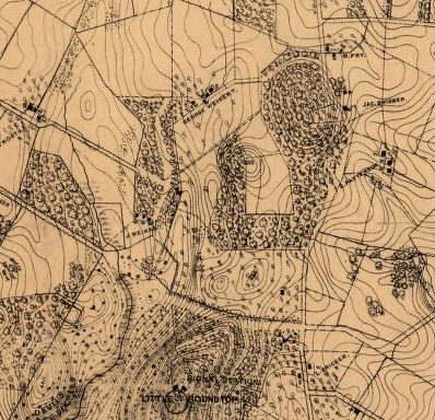
The Wheatfield was part of Rose farm. A narrow clay road along its northern edge formed the border between the Rose and Trostle farms, and on the other side of the road from the wheatfield was a thick woods. The the west of the wheatfield stretched a rocky, wooded ridge or knoll, later known as the Stony Hill. Cutting off the south-westernmost corner of the Wheatfield was a rail fence. It stretched from the Stony Hill to a stone wall. The stone wall ran about 300 yards along the entire southern end of the field. The stone wall was described by one general's report as "not breast high." The height was no more than a foot and half in some places, but infantry from the Third Corps positioned there earlier in the afternoon had been able to bolster it with rails, earth, and timber. Beyond the stone wall to the south was the Rose's Woods, where the first Wheatfield fighting began. The western branch of Plum Run ran through the woods. To the east of the Wheatfield was Houck's Ridge, yet another bit of high ground. It extended from Trostle's Woods to the north all the way down to the Devil's Den.
Stony Hill, the rocky knoll to the west of the Wheatfield has been variously described as a "thick strip of woods," and a stand of timber "interspersed with rocks and boulders." General Kershaw, commander of the South Carolina Brigade in McLaw's Division that attacked the stony hill, described it as "covered with heavy timber and thick undergrowth, interspersed with boulders and large fragments of rock." With the rocks, boulders, trees, and high ground, it made for a formidable defensive position.
| Officers Killed |
4 |
| Enlisted Killed |
24 |
| Officers Wounded |
10 |
| Enlisted Wounded |
97 |
| Officers Captured or Missing |
0 |
| Enlisted Captured or Missing |
40 |
| Aggregate (out of 426) |
175 |
Back to the main Pennsylvania 62d Infantry Regiment page?
This page authored and maintained by John R. Henderson
(jhenderson @ icyousee.org), Lodi, NY.
Last modified: 28 June 2015
URL: http://www.icyousee.org/pa62d/gettysburg.html